According to the International Energy Agency (IEA), methane is responsible for 30% of global warming since the Industrial Revolution. However, unlike carbon dioxide, methane breaks down in the atmosphere more quickly.
Approximately 40% of human-caused methane emissions come from the energy sector. Identifying and reducing methane emissions is crucial for mitigating climate change.
Google and Environmental Defense Fund (EDF) are partnering to tackle this challenge. They have previously mapped methane leaks in cities using sensors on Street View cars.
In addition, they are now using satellite imagery to track methane emissions on a global scale. Now, they are using a combination of satellite imagery and Artificial Intelligence(AI).
MethaneSAT: A Satellite to Monitor Methane Emissions
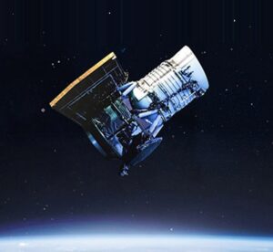
MethaneSAT, a satellite designed to provide the most comprehensive picture of methane emissions across the planet, is set to launch on a SpaceX Falcon 9 rocket in early March by EDF and its partners.
It will orbit Earth 15 times a day at an altitude of over 350 miles, focusing on measuring methane in major oil and gas producing regions.
MethaneSAT can detect both large emissions from single sources and smaller methane sources spread over a wider area.
Google Cloud AI Algorithms: Tracking Emissions and Visualizing Energy Infrastructure
Google Cloud AI algorithms will be used to calculate emissions at specific locations and track them over time.
AI will also be used to visualize oil and gas infrastructure. Google will use AI to detect features like roads and traffic signs in satellite imagery for Google Maps.
Combining methane maps with oil and gas infrastructure maps will provide insights into the sources of emissions. This information can help energy companies stop leaks.
Open Data for Action: Towards a Sustainable Future
The information gathered from this collaboration will be publicly available on the satellite’s website and Google Earth Engine later this year.
“By making the MethaneSAT dataset available on Google Earth Engine, which has over 100,000 users, users can more easily detect trends and understand the correlation between human activity and environmental impact,” writes Yael Maguire, Google’s Vice President and General Manager of Geo Developer and Sustainability.
This means that Google Earth Engine users can overlay methane data with other maps and see how methane emissions have changed over time.
Google and EDF’s Commitment: Fighting Climate Change with Technological Innovation
This innovative collaboration demonstrates Google and EDF’s commitment to combating climate change through AI technology.
With more accurate and comprehensive data on methane emissions, more effective mitigation measures can be implemented.
Read Also: Era Baru Fotografi: Kamera Mirrorless Nikon Hadir di ISS!